The Great Game: Anglo-Russian encounter at the borders of Pamir, Hindu Kush and Karakoram
The last act of the “Great Game” or “Большая Игра” (Bolshaya Igra), was played where the Tsarist Empire, the British Empire and the Chinese Empire joined in one of the highest and, at that time, one of the most inaccessible places of the planet. There, bristling with giant mountains, Pamir, Hindu Kush and Karakoram ranges converge.
English translation of a Bernard Grua’s article published on Agoravox: “Le Grand Jeu : rencontre anglo-russe aux confins du Pamir, de l’Hindou Kouch et du Karakoram”
There, at the end of the nineteenth century, passionate explorers, at the risk of their lives, faced extreme altitudes, deadly winds and colds, snow-capped passes swept by avalanches, rocky defiles threatened by flash floods or by devastating landslides. These military men, officially on availability or on hunting permits but, in reality, cartographers, spies, even diplomats, were, in their time, part of a small elite celebrated by the very honorable Geographical Societies of London or Saint Petersburg.
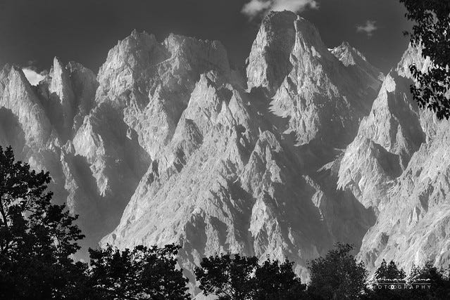
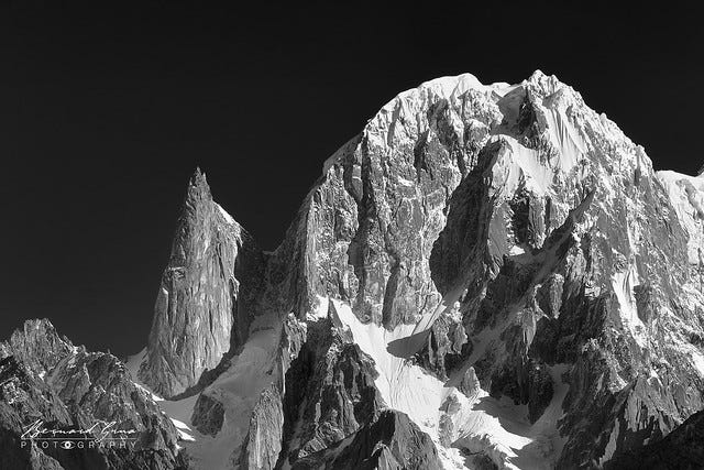
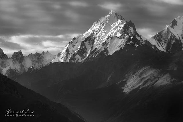
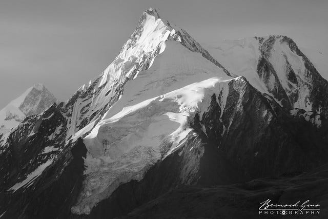
Today, Britain has gone. Russia is gradually pushed away by a Chinese dragon reborn and exiting its borders. The Great Game, an amazing page of history, is forgotten. The same goes for the men who wrote it. Their exploits do not enter into the construction of any national discourse either in their countries of origin or in those of their particular peregrinations. Nowadays, foreign visitors are led to rever myths without real content or evidences of a silk route rather than to a breathtaking epic, however not so distant, and which would remain documentable locally. The framework of these inconceivable adventures is of course always there with its routes, its vertiginous abysses, its black rocks (Karakoram), its sparkling summits, its powerful glaciers, its tumultuous rivers, its isolated villages and its pastures of altitude.
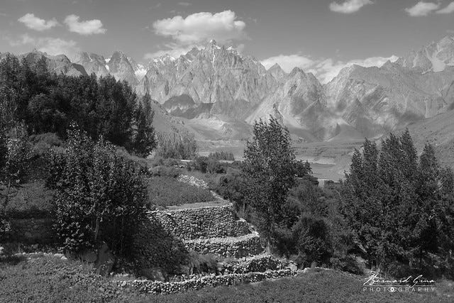
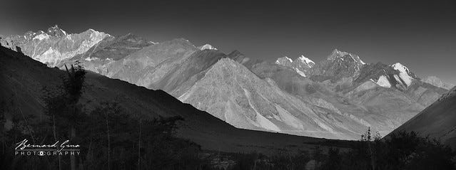
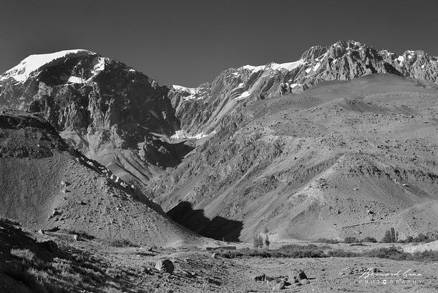
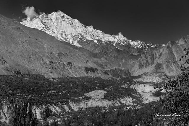
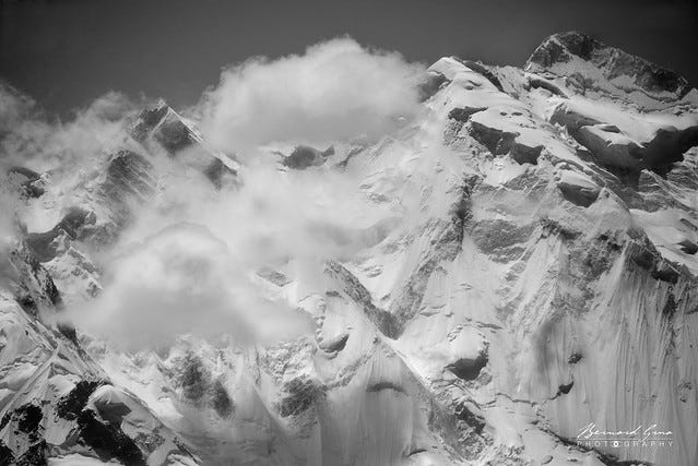
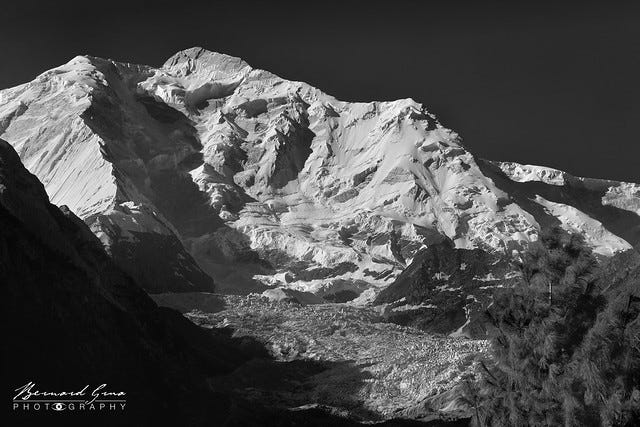
Black and white photographs taken along the Karakoram Highway will attempt to evoke, very partially, its grandeur. They will also try to recall the determination of those who have devoted their best years, even their last breath, to roaming these inhospitable places. Which, despite all the threats, kept captivating them.
Kunjerab Pass, the door of high Chinese Pamir
Leaving China, coming from Kashgar or Tashkurgan, we enter Gojal, the upper part of Hunza Valley, via the Kunjerab Pass located at 4,693 meters. This presents a typical Pamir topography. Bordered by glaciers and rounded peaks contrasting with the sharp ones of Karakoram, which are revealed later, it is a wide plateau with short grass, where, mainly on the Chinese side, yaks graze in summer.
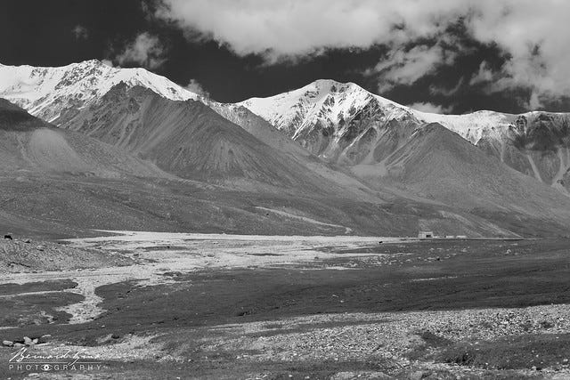


From the pamir of Kunjerab to Sost, at an altitude of 2,800 meters, a large drop plunges southwards through tight laces on the side of a scree or through dark gorges framed by huge mountain sides.


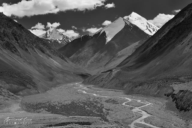
Gojal, Upper Hunza Valley, bordered by Afghanistan and China
Once, during summer 1889, Francis Younghusband, near Shimshal Pass (between China and the northeast of the kingdom of Hunza), 4,735 meters, met Captain Bronislav Grombchevsky. They shared meals, vodka and brandy. The Russian officer showed the map he had in his possession. Younghusband was shocked by the advance of his competitor and opposed the continuation of his armed expedition to Leh through Ladakh, already under British control. As a result, confining his winter exploration between Ladakh and Tibet, Grombchevsky lost all his luggage and his horses. He and his team survived with difficulty.
Many years later, Younghusband, having got a peerage, being the president of the Royal Geographical Society, received a letter from Grombchevsky, sent shortly before his death. After having been decorated many times under the Czarist regime, after having attained the rank of lieutenant-general and held important positions, Grombchevsky was dismissed and so ill that he could not leave his bed. The Bolsheviks had deprived him of all his possessions and exiled to Siberia, from where he managed to escape and to join Poland from which his family originated.
After leaving Grombchevsky and carrying out his own explorations, Younghusband headed, in November 1889, towards the southwest in the direction of Gulmit, 2,465 meters, near Passu, 2,500 meters. He met with Safdar Ali, the Mir (king) of Hunza to warn him against his relations with Grombchevsky (it has been said, without it being possible to confirm it, that the establishment of a Russian post was planned in Karimabad). Safdar Ali was also urged to stop sending his subjects for looting via the Shimshal Pass. The latters attacked caravans traveling to Xinjiang from Ladakh via the Karakoram Pass, 5,540 meters.
These two requests were without effect. It is true that China was not pushing hard in this direction. Indeed, China had no desire to see Indian tea invading its markets. For his part, Safdar Ali was probably trying to raise the stakes between what he believed to be rivals fighting over his favors.
“He thought that the empress of India, the tsar of Russia and the emperor of China were the chiefs of neighboring tribes” (Younghusband).
He was, in any case, oblivious to the extreme susceptibility of the English people regarding access to passes and corridors that could eventually lead Russian troops to the Indian Empire. The potentate preferred to multiply boastfulness, insults and requests for bribes.
In August 1891, at Bozai Gumbaz (Afghan Pamir), 3,800 meters, Francis Younghusband found himself facing Colonel Yanov and his Cossacks. The meeting was particularly cordial. Reciprocal invitations were exchanged. A toast was offered to the Czar and Queen Victoria. However, Yanov said that the entire Pamir was, now, the property of Russia. He prohibited Younghusband to return directly to Gilgit through Afghan territory, claimed by Russia (before, presumably, crossing Irshad pass, 4,979 meters, then Chapursan Valley). Younghusband had to access the kingdom of Hunza by China. Maybe, he went through Kunjerab pass?
It is not impossible that the imposed detour was a retaliatory measure taken because of the turpides previously inflicted on Grombchevsky. This event, however, pushed British Russophobia to new heights. It brought to its maximum the tension between Russia and Great Britain. Through military preparations, the latter obtained the Russian withdrawal from the Afghan Pamir and decided to lock its control over the state of Hunza by sealing the fate of Mir Safdar Ali.
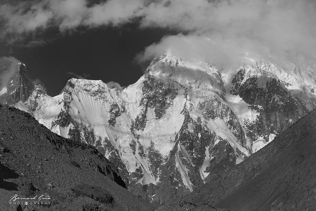
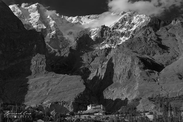
Karimabad, the ancient capital of Hunza kingdom in the heart of Karakoram
On his own initiative, Safdar Ali would work on creating the pretexts leading to his loss. In winter, in the absence of the Gurkhas locking the Shimshal Pass, he resumed his deadly assaults on the caravans between Ladakh and Xinjiang. He believed that Russian and Chinese forces would fly to his aid, if necessary. He even began to attack neighboring communities and Kashmiri possessions. In November 1891 the British went on the offensive, attacking a bunch of military works from Nagar and Hunza as they headed upward north from Gilgit. Safdar Ali fled from Baltit Fort (Karimabad, 2,400 meters) and took refuge in Kashgar (Xinjian). The British detachment replaced him with his half-brother, Muhammad Zafim. The latter reigned from 1892 to 1938. The state of Hunza and the neighboring Nagar were incorporated into the British Indies. Furious, the Russian foreign minister, Nicolas de Giers, exclaimed:
“They slammed the door in our face.”
In Baltit Fort (Karimabad), it is possible to see two rifles which are the only Russian weapons, according to local guides, to have been found there by British people, while Safdar Ali had boasted of being in possession of a full arsenal from Saint Petersburg. Queen Victoria’s subjects claim to have observed samovars, one of which is still visible, Russian and Chinese mails, as well as a portrait of Tsar Alexander III. In 1974, the kingdom of Hunza was annexed to Pakistan. It has long been the most peaceful, educated and welcoming part of this country. Today, the Shimshal Pass is as isolated as before but there is still a large summer pasture very frequented by the Wakhis of Hunza. It is also a high place for yak polo.
In 1947, Great Britain packed up. Bridges were cut with the Indian crown jewel which sank into the horrors of partition and its wars, while undergoing two Chinese annexations (Shaksgam and Aksai Chin). In 1991, Russian Turkestan was dismembered at the same time as the USSR by new independent states trying to build an identity and to write a national history, while Moscow still has not completely got rid of its tutelage reflexes towards its “near abroad.”
Today, China is militarily present in the Tajik Pamir, in the Afghan Pamir and, of course, in Xinjiang. It has the upper hand on the Karakoram Highway which descends through the entire Hunza valley from the Kunjerab pass. It is the first time, in at least two millennia, that all of the Pamirs have been controlled by one single country. So vanishes the work of the Great Game.

Looking back at history, we only remember and celebrate bloody battles or conquerors who carried out massacres. They are often idealized for questionable ideological purposes. In one of the ex-countries of the Great Game, these death pulsions go as far as to parade children in strollers, disguised as cannon fodder, for the dismaying pride of their parents. There would be so much better to do. And yet, who mentions the Russian and British heroes example of this incredible competition in the mountains of Upper Asia? Who is inspired by it? Who cares? Their names are not taught. They don’t even have a monument to figure out their efforts and sacrifices. Thus, inexorably, disappears the memory of the legendary men of the Great Game.
Bernard Grua, Nantes, Bretagne, France — 2019
Link to Bernard Grua’s photo albums of mountains and people from north Pakistan
Notes
Pakistani places mentioned in this text from North to South and down the Hunza River along the Karakoram Highway:
- Kunjerab Pass leading from Xinjiang to the Hunza valley
- Sost (with the west departure of the track towards Chapursan valley and Irshad pass leading to Bozai Gumbaz in the Afghan Pamir)
- Passu (with the north west departure of the track towards the Shimshal Valley and Shimshal Pass)
- Hussaini
- Gulmit
- Karimabad (capital of the former kingdom of Hunza)
- Aliabad
- Ghulmet
- Gilgit (British advanced military base in the late 1880s)
Main information source :
Peter Hopkirk : The Great Game, On secret service in High Asia ; John Murray Publisher (1990).
All pictures are © Bernard Grua and cannot be used without his written approval.
Bonus
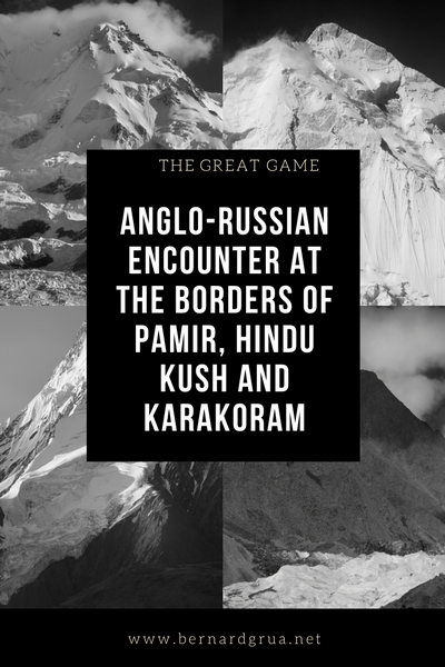
You liked this article? Save it on Pinterest
List of all stories about the same topic, on Medium, by the author
- How past and present religions built a tradition palimpsest in a high valley of northern Pakistan
- Wakhi mountain houses of Zoodkhun in Chapursan Valley, northern Pakistan
- Portraits, Wakhi in relation with other people of their areas
- Wakhi people and Pamir life ex-libris
- What to see and what to do in a short period of time in Hunza
- The Great Game: Anglo-Russian encounter at the borders of Pamir, Hindu Kush and Karakoram
- Zoodkhun Village in Chapursan Valley preserves a scenic and authentic mountain oasis landscape
- Zoodkhun, Chapursan Valley, a life environment determined by altitude and remotness
- Chapursan Valley, where Zoodkhun nights unveil the universe
- What place for Zoodkhun into the global world?
- Karakoram Highway, a prototype of the new Silk Roads?
- Some reflections about the development of a responsible and community based tourism in Hunza Valley
